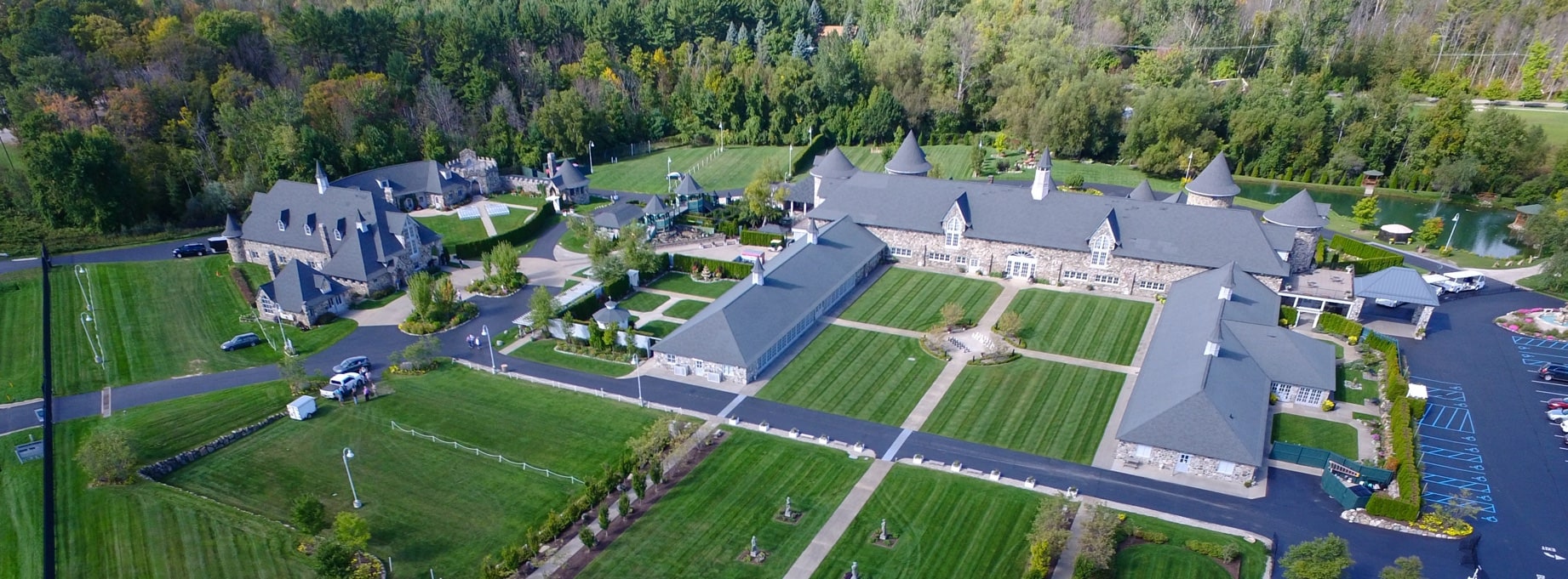
Map and Directions to Castle Farms
Castle Farms is located at:
5052 M-66 North
Charlevoix, MI 49720
Please click on the map below for directions from your location.
Traveling By Air?
Traverse City Cherry Capital Airport is located 50 miles south of Charlevoix. Flights can be connected through Detroit or Chicago. The flights book up quickly during the summer. Pellston Regional Airport is located 40 miles north of Charlevoix. Direct flights are available from Chicago through Lakeshore Express. Because both airports are small and serve a popular vacation area, please make reservations as far in advance as possible.
By Car from Traverse City
Take US-31 North 45 miles north to Charlevoix. Turn right at the light at M-66. Drive about 2 miles. Castle Farms is on the left side of the road.
By Car from Detroit
Castle Farms is 265 miles northwest of Detroit. Take I-75 North about 200 miles. Take Exit 282 at Gaylord. Turn left and stay on M-32 for 28 miles to East Jordan. Turn right on M-66 North. Drive about 11 miles. Castle Farms is on the right side of the road just before you get to Charlevoix.
By Car from Chicago
Castle Farms is 365 miles north of Chicago. Take I-90 East for 33 miles. Take Exit 21 to I-94. Stay on I-94 East for 103 miles. Take Exit 74 to Business I-94. Drive 2.5 miles to US-131. Continue for 195 miles. Turn left on M-66/ Mancelona East Jordan Rd. Drive 28 miles. Castle Farms is on the right side of the road.
By Car from Mackinaw City
Castle Farms is 55 miles south of Mackinaw City. Take I-75 South to Exit 336. Take US-31 South for 50 miles. You will go through Charlevoix. Turn left at the light at M-66. Drive about 2 miles. Castle Farms will be on the left side of the road.

